July 24, 2020

Mineral prospecting is a fundamental stage in the discovery and characterization of a mineral deposit. A prospecting campaign involves recognizing areas with economic potential and selecting priority targets on a regional scale, progressively moving on to larger scales where detailed studies will be carried out.
The activity also involves major financial risks, since discovering economically viable deposits takes time and sometimes several failed attempts.
Mineral prospecting methods are diverse and depend on the type of substance being studied. In today's article, we list some prospecting methods and their main characteristics, see below.
Bibliographic research is an important ally in gathering existing information and studies already carried out in the target region. Preparation for mineral prospecting begins with research into articles and publications, as well as studying geophysical and geological maps and reading available technical reports.
For this survey, searches should be carried out using different keywords that clearly define the objective of the research or the information being sought. At this stage, a significant amount of information will be found, which should be filtered according to the quality and relevance of the content.
For those who wish to escape the large flow of information that direct searches provide, it is possible to carry out searches on more specific platforms, according to the information you wish to obtain:
Google Scholar: repository of theses, scientific articles, abstracts, monographs, dissertations and books;
Scielo: articles and other academic works. This platform has an advanced search tool, where you can select the index you want to search, such as author, journal, abstract or title;
ResearchGate: file and publication sharing, forums, methodological discussions, as well as semantic search for abstracts of publications stored in the repository;
CPRM: access to corporate databases that bring together information on geology and mineral resources in geological maps, available free of charge for download;
IBGE: access to topographic sheets at various scales, also free of charge.
SEDAR: publications by listed companies. On the platform you can find Public Technical Reports (NI43-101 or JORC).
When the focus of the research is a specific substance and when there are no similar occurrences in the region, the bibliographic search should be carried out in order to analyze in the first instance which types of rock could be the source of the mineral.
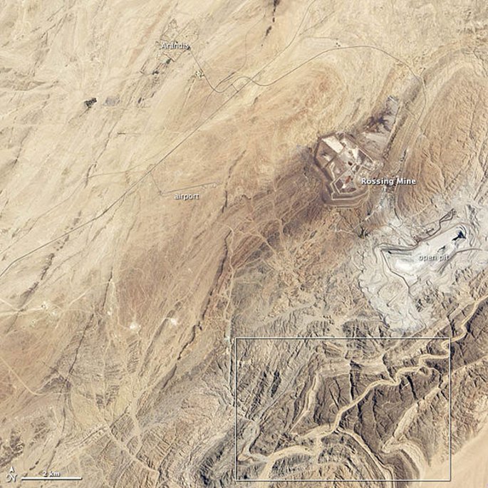
Aerial image analysis can play an important role in identifying new mineral prospecting targets. The use of remote sensing techniques, through the visual interpretation of satellite/radar images, is an effective solution for analyzing different forms of landscape apprehension, which are fundamental for identifying and interpreting the various geological elements exposed in the images.
The different types of sensors (satellites) available today make it possible to create DEMs (Digital Elevation Models), map geological structures, make pre-field maps, identify landforms and logistical planning (identifying roads, access routes, drainage, etc.).

Some aerial images can be obtained free of charge from platforms such as
Google Earth: This platform makes it possible to obtain good spatial resolution images that can be georeferenced for use in mineral prospecting.
INPE (National Institute for Space Research): access to a database with images from more than 10 satellites. The standard means of sending images (free of charge) is by file transfer (FTP) via the Internet.
Terra Incógnita: Program for downloading maps from web sources or maps from local files to various programs or GPS devices.
For those who want to invest a little more in this method, some modern satellites have resolutions capable of identifying targets for mineral prospecting using the reflectance of minerals (the way each mineral reflects or absorbs sunlight, recorded by airborne or orbiting sensors).
In this case, with the help of the various spectral signature libraries and satellite image processing software, it is possible to identify anomalous areas of mineral concentration or groups of minerals, making it possible to identify zones of hydrothermal alteration and anomalous mineral concentrations.
Depending on the availability of information, the initial planning and interpretation of the defined mapping area can be carried out before the field visits are made.
In this case, it is possible to assemble a database (shapes, high-resolution images, geological maps, digital terrain model) and integrate them into a preliminary map, which will bring together the main regional geological information, serving as support for the start of local geological studies. To obtain this information it is possible to use platforms such as:
CPRM: geological, geophysical, topographical maps, drainage maps, etc...
IBGE: topographic maps
GOOGLE EARTH: aerial images
Detailed and in-depth knowledge of the local geology is the basic condition for a successful exploration plan. This is in addition to other factors such as the structural conditions, stratigraphy and petrography of the area. Field surveys are a fundamental stage in this reconnaissance.
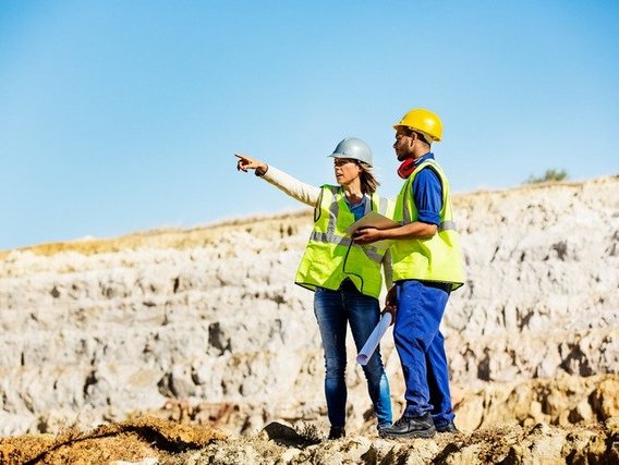
The fieldwork starts with initial visits, which can be made on foot or by vehicle. The aim is to familiarize oneself with the terrain and examine outcrops, known occurrences and road cuts or slopes.
Initial field surveys should preferably be carried out after a bibliographical study and preliminary photointerpretation of the area of interest, directing the observations that should be made in the region towards geologically more promising sites, where we know of complete stratigraphic sections, important mineralizations or even more common photointerpretation patterns.
Careful study of outcrops, especially rock types or formations that are being encountered for the first time, will facilitate the geological mapping stage of the area.
In Geological Mapping, the professional responsible will gather all the information obtained and interpreted in bibliographic, field and laboratory studies into a map that seeks to determine the geographical position of rocks that are under the surface and their attitudes. The end product is a georeferenced Geological Map, presenting lithological and structural information on the geological bodies present at the study site.
The original data obtained from the mapping must be organized in the form of a Service Report and/or a computer database containing: a map of "points", petrographic analysis sheets, chemical analyses, a transcription of the booklet, etc.
The report should also focus on the important aspects of geological knowledge of the area within the scope of mineral prospecting, as well as the facts deemed fundamental and the interpretations and hypotheses relating to geological evolution.
Exploration geophysics investigates the first five kilometers of the earth's crust. This is done by observing the effects on physical fields and wave propagation caused by variations in the physical properties of crustal materials. The variations in physical properties are related to the concentration of minerals that are economically important (ore minerals) or to the structures where these minerals are found.
As the concentration of ore minerals is controlled by geological phenomena, it is possible, based on knowledge of these phenomena, to establish a prospecting strategy with the most suitable geophysical methods for their detection.
To study geology on a regional basis, it is possible to use public maps of geophysical surveys that are made available to the public by some Geological Services.
For a more detailed study that provides greater assertiveness in the local geological study, it is recommended that a more detailed geophysical study be carried out, using techniques such as gravimetry and magnetometry.
The costs of geophysical methods vary widely, with flight surveys being the most expensive, while local and walking methods are more affordable.
It is the most common method for prospecting the majority of substances extracted by mining, capable of providing important information on the configuration of the subsurface, supporting the recognition of the quantity and quality of the material studied.

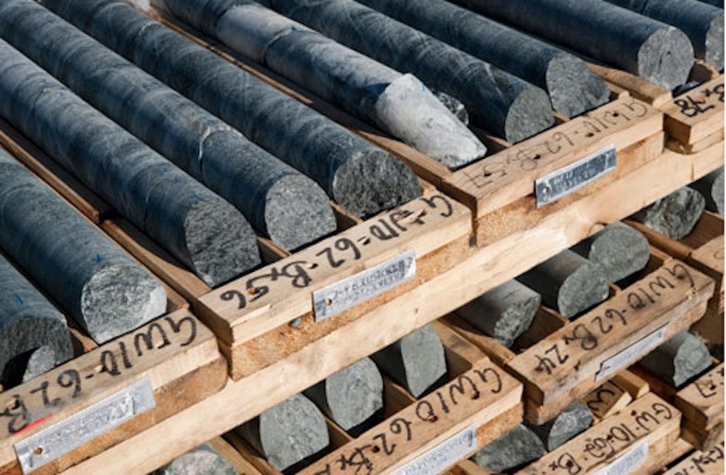
The boreholes should be planned with the aim of providing the greatest amount of information on the distribution of contents in the mineral deposit, as well as providing a reasonable basis for geological interpretation.
The cores that will be collected along the drilled interval will optimize the representativeness of the mineralized body, reducing uncertainties in both geological modelling and mineral resource estimation.
Costs vary according to the type of rock to be drilled and the depth to be reached.
In short, there are various mineral prospecting methods and ideally they should be used together to gain a better understanding of the target area. Thus, the stages of a mineral prospecting process can include: